What are base maps?
Explore base maps in RenewMap—satellite, street, wind, and solar layers—and learn how to change the map’s background to suit your analysis.
In RenewMap, base maps—also called base views or base layers—provide the foundational mapping layer that displays geographic context for renewable energy projects. The base map appears beneath all other data layers, helping you view project boundaries, transmission lines, and infrastructure in relation to terrain, roads, or resource potential.
Available base maps
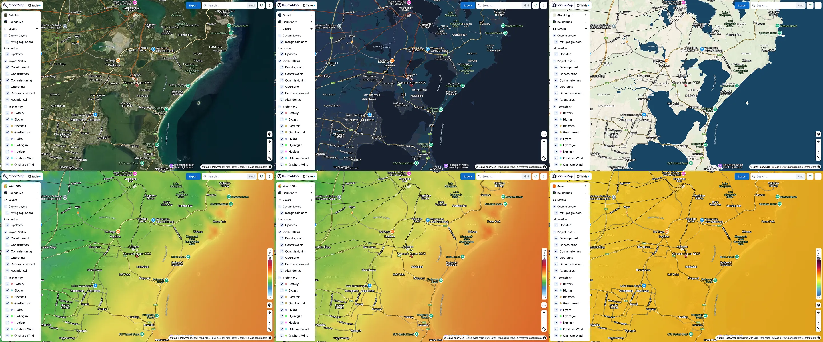
RenewMap supports several base maps, including satellite and street-view imagery, and wind and solar resource maps:
- The Satellite base map displays the Earth’s surface as viewed from space. In RenewMap, the satellite base map has a 9.5m per pixel resolution. Objects smaller than 10m may be obscured.
- Street base maps display roads, railways, building, and other urban infrastructure. RenewMap supports two street maps. The standard Street map is designed in dark mode. The Street Light map is designed in light mode.
- Wind resource base maps display the mean wind speed at a certain height above ground level (AGL), as a gradient. RenewMap supports two base maps for wind speeds at either 100m AGL or 150m AGL.
- The Solar resource base map shows irradiance, or the amount of solar power available across a specific area of the Earth’s surface. RenewMap’s solar base map shows irradiance in terms of kilowatt hours (kWh) over kilowatt peak (kWp). This describes how much energy a solar photovoltaic (PV) system produces per kilowatt of installed capacity in a specific location.
How to change the base map
Your current base map selection appears at the top of the layer panel. The default base map is the Satellite map.
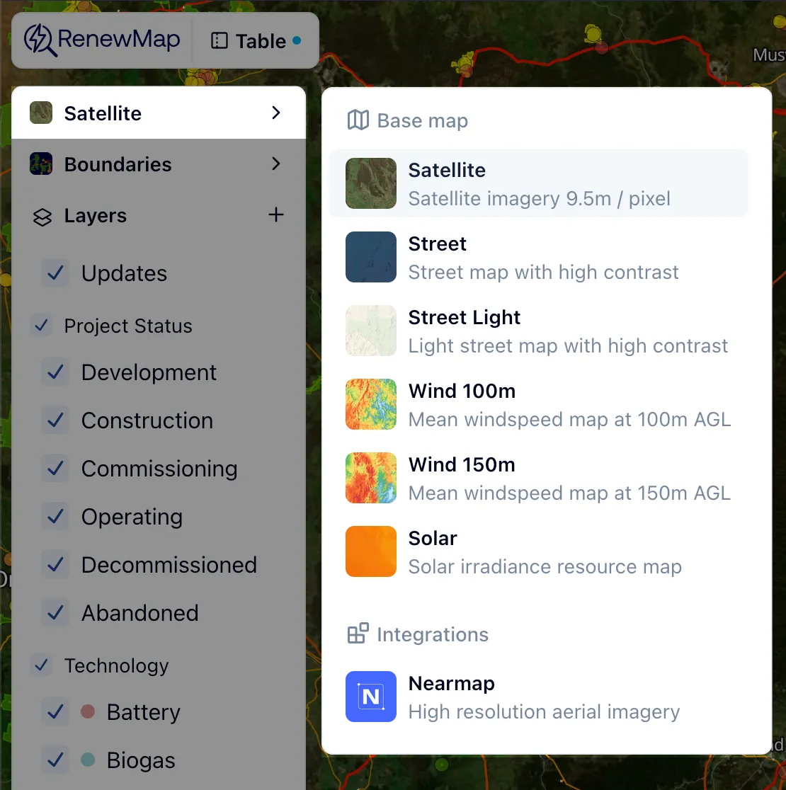
To change the base map:
- Select the current base map in the layer panel.
- Select your desired base map. The interactive map loads the selected base map.
You can add custom base maps like Google Satellite or Hybrid imagery as a custom layer Learn more about the adding custom layers from a URL.