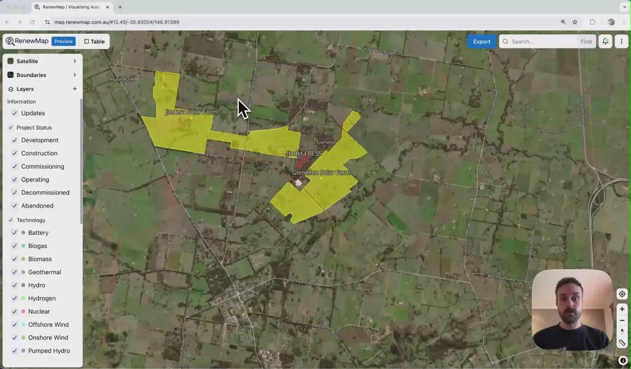
Aerial imagery
Get high-resolution, aerial imagery in Renewmap with your Nearmap subscription. Validate project sites, track construction progress, and make confident decisions with accurate ground truth data.
- High-resolution ground truth data
-
Get unmatched clarity and detail with Nearmap’s high-resolution aerial imagery, captured multiple times per year across 95% of the Australian population.
- Real-time project monitoring
-
Track construction progress and site changes over time with frequently updated imagery. Monitor renewable energy developments as they happen and validate project sites remotely.
- Complete visual and data analysis
-
Overlay aerial imagery with RenewMap’s comprehensive project data, including infrastructure footprints, Renewable Energy Zones, and resource maps.
Powered by Nearmap
RenewMap's partnership with location intelligence pioneer Nearmap brings industry-leading aerial imagery directly into your renewable energy workflow.
Read about our Nearmap partnership
Get started today
Bring the value of RenewMap to your organisation.
Book a demo with our team now.